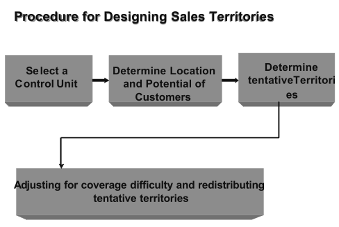
In setting up or in revising sales territories, there are four steps:
- Selecting a basic geographical control unit.
- Determining sales potentials in control units.
- Combining control units into tentative territories.
- Adjusting for coverage difficulty and redistributing tentative territories.
Selecting a Basic Geographical Control Unit
The starting point in territorial planning is the selection of a basic geographical control unit. The most commonly used control units are counties, Zip code numbers, cities, standard metropolitan statistical areas, trading areas, and states. Sales territories are put together as consolidations of basic geographical control units.
There are two reasons for selecting a small control unit.
One reason is to realize an important benefit of using territories, the precise geographical identification of sales potential. If the control unit is too large, areas with low sales potentials are hidden by inclusion with areas having high sales potentials, and areas with high sales potentials are obscured by inclusion with those having low sales potentials.
The second reason is that these units remain relatively stable and unchanging, making it possible to redraw territorial boundaries easily by redistributing control units among territories. If, for example, a company wants to add to Jones’s territory and reduce Smith’s adjoining territory, it is easier to transfer county-sized rather than state-sized control units.
Counties: In the United States, the county is the most widely used geographical control unit. The county is small enough to prevent the obscuring of areas with high and low sales poten- tials, and statistical information on the more than, 3,000 counties in the United States is readily available. This makes it inexpensive to develop market and sales potentials on a county- by-county basis. Further- more, the county typically is the smallest unit for which governmental sources report statistical data. The county is a smaller market division than the typical sales territory, so a company using counties as control units can build up or revise sales territories without collecting new data on potentials.
Zip code areas: A basic geographical unit increasingly used by U.S. companies is the Zip code area. There are more than 33,000 Zip code areas in the United States, so the typical Zip code area is smaller than the typical county.
Using Zip code areas as the basic geographical units has advantages. The Zip code areas generally reflect economic characteristics of the areas-in marked contrast to counties, cities, and states, which represent political subdivisions. The Zip code system permits a precise definition of markets according to economic and demographic characteristics. Each Zip code area is a convenient unit for which to collect data on market and sales potentials.
Cities: When a company’s sales potential is located entirely, or almost entirely, in urbanized areas, the city is used as the control unit, although, in some cases, both the city and the surrounding county (or counties outside the city) are used as “twin” control units. The city rarely is fully satisfactory as a control unit, inasmuch as most grow beyond their political boundaries. For many products, suburbs adjacent to cities possess sales potentials at least as great as those in the cities themselves, and, in addition, they can often be covered by the same sales personnel at little additional cost.
Metropolitan statistical areas: Companies whose markets have expanded beyond city limits and into suburbs and satellite cities find the Metropolitan Statistical Area (MSA) a good choice for basic geographical control unit. An MSA is a geographic area with a large population nucleus together with adjacent communities that have a high degree of economic and social integration with that nucleus. An area is designated an MSA in one of two ways:
- If there is a city of at least 50,000 population
- If there is an urbanized area of at least 50,000 population with a total metropolitan population of at least 100,000.
MSAs are defined in terms of entire counties
Because the MSA definition is in terms of counties, the tremendous amount of statistical data available for the counties themselves may also be tapped. If the planner is willing to accept the definition and boundaries for each metropolitan statistical area, it is easy to secure data for use in estimating sales potentials. In fact, because the definition is in terms of whole counties, the planner is free to add to or subtract from the official roster of metropolitan statistical areas.
Trading areas: A logical choice for a geographical control unit is the trading area, since it is based upon the natural flow of trade. Formally defined, a trading area consists of the geographical region surrounding a city that serves as the dominant retail or wholesale center or both for the region. The trading-area concept recognizes that consumers, retailers, and wholesalers pay scant attention to political boundaries in deciding where to buy. Consumers, for example, regard convenience and the merchandise selection available as key factors in deciding where to shop. Shopping across political boundaries is common, especially where population concentrations are close to state lines and where suburban areas have spread into counties surrounding cities. Many consumer products, including most specialties and shopping goods, are available almost entirely in large regional shopping malls. So residents of small towns and rural areas must travel to these malls (or, of course, order by mail or phone). Increasingly, too, residents of the older areas of cities, when they are in the market for these items, go to outlying shopping malls. The main problems in using trading areas as control units are defining them and estimating sales potentials.
Depending upon the product, both retail and wholesale trading areas vary in size and shape and change over time. Rural consumers buy work clothes and routine supplies in the nearest small towns, but they go to regional shopping malls or larger cities to shop for dress clothing, and even farther to buy expensive furniture or jewelry. Each such location is the focal point for a trading area, at least for products customarily purchased there. Trading areas for products purchased fre- queenly and routinely are much smaller in size, and consequently more numerous, than are those for luxury products.
Precise delineation of trading areas requires primary research into, and quantification of, customers’ buying habits and preferences. Considerable expense is involved in dividing market and sales potentials for counties or other political subdivisions among two or more trading areas. Consequently, most companies using trading areas as control units adjust trading-area boundaries to county lines.
States: States, as basic geographical control units, provide a rough basis for subdividing the national market. There are two situations in which the fixing of territorial boundary lines along the borders of states is justifiable. One is the company with a small sales force covering the market extensively rather than intensively; there are only a few customers and prospects, but they are all across the nation. The other situation is the company first seeking national distribution, which assigns its sales personnel to territories consisting of one or more states as a temporary expedient. As soon as feasible, a change is made to a smaller control unit. The main difficulty in using states as basic control units is that they are political rather than economic subdivisions
